West Highlands Way
Lauren and I were both so excited before boarded the plane for the UK to get to spend some time in nature and away from cities during our hike through the west highlands of Scotland. Before we hit the trail we need to do some last minute preparations and so we had planned a couple days in Glasgow to pick up any final hiking essentials.
Almost immediately after stepping off the train in Glasgow something inside of us harmonized with the vibe of this city. It’s funny that when we were newbie travelers in Central America other seasoned backpackers told us that sometimes you will instantly fall in love with a city and other times you may quickly dislike a city and want to move onto the next. I cannot understand the rhyme or reason to it, but I do agree with them and have experienced it both ways.
Our first day in Glasgow we got the boring stuff out of the way, mostly running errands for warmer clothes and waterproof pants. Since we were going to be off the grid for the next week we deserved a fun night out and some beers so we went to a venue Lauren found for some live music. We listened to some sample music from the group and they sounded like a hippier version of The Ballroom Thieves so we figured we would like them. The opener for the group was very talented at playing classical style guitar and he had written what seemed like extremely technical songs backed up with a good voice. The headliner came on the stage and began with telling us how they had tragically lost their son at 10 months old and the album they would play tonight was their tribute to him written during his short life. Halfway into their first song Lauren and I looked at each other thinking if all of their songs are this strange and ultra-hippie, we may not be here for long. When the woman began singing halfway into that first song we were so impressed with her beautiful and powerful voice we decided to give them a chance. As the night progressed, their loyal group of followers slowly became our entertainment as one by one they began to populate the dance floor. At the start there were only two girls dancing like hippies at burning man and by the end of the night the dance floor was a tangled mess of people wildly waving their arms above their heads and sporadically jumping up and down. We were like deer in headlights, entranced with the bizarre scene taking place in front of us, so much so we did not think to take photo or short video to share the experience. The best way I can describe how the dance floor looked is like a kettle of popcorn reaching that optimal temperature when the kernels all start violently popping. Wait it gets more bizarre. Towards the end of the night Lauren gets up to use the restroom and I take a sip of my beer and casually glance back at the dance floor as Lauren is walking away. I just about spit out my beer in shock when I see a girl nonchalantly walk by topless. I had not taken the singer seriously earlier in the night when she said we were all going to get naked and dance around, but apparently this young lady took the words to heart. Another very interesting character of the night was an older hairy guy in skin tight rainbow pants, a belly shirt, tiny black backpack, and top hat. At the end of the night the band wanted a picture with their followers and asked the crowd for a volunteer to take the photo, nobody raised a hand. Lauren volunteered to hop on stage and take the photo.
The start of our hike began with an early morning train ride from Glasgow to Milngavie, the official start of the trail. Lugging our packs the mile or so to the train station we both worked up a sweat under the weight as we rushed to make sure we didn’t miss the only morning train to Milngavie. Both of us were silently singing praise to the baggage service that will be transporting our big bags every day from stop to stop. Hiking an average of 12 miles a day with 50 lbs in two bags on our back and front for eight days would be memorable, but for the wrong reasons. While waiting on our platform for our train which was to come next, we both looked at each other when we noticed the screen had mysteriously changed about 3 minutes before our train was due to arrive and our stop was no longer listed. The train pulled up we got on and once the conductor announced it was only going one stop we flew back off before the doors slammed shut. Lauren ran to find someone to question about what was going on while I got on the station wifi to check the next train we could take. Every single train to Milngavie was cancelled. Looks like our hike just got a little bit longer! Just kidding our last resort was a taxi that would likely cost us about $80. Luckily Lauren ran back down just in time with instructions to get on the next train, get off at Partick and get on the very next train to Milngavie. We did as we were told and even laughed a little on the phone when we found out from our baggage service that all others were arriving by taxi. Our elation only lasted a few stops when the train came to a halt for about 20 minutes. We could not understand the conductor giving updates because of how awful the speakers were and we were watching the minutes tick away towards 9am which was the cut off time for us to drop our bags on the first day. We had spoken with our baggage service, but not knowing how late we were going to be trapped on the train we were unsure he would wait for us. Finally we got past the signalization issue with the trains and arrived in Milngavie. We were so excited to see the van with Baggage Freedom on the side still waiting patiently for our bags.
Spontaneous musical number
In keeping with our mature millennial spirit we decided to do this hike the old fashion way, with a map and the stars (mostly because we didn’t bother to pick up a compass). Now being millennials we did have a backup plan in case we lost or became frustrated with the map. Using maps.me we were able to export a .klm file from google maps and import that shape file into maps.me for pinpoint accuracy while offline! If you want to know how to do this yourself check out our how to post here. However, we hope not to have the need to use it. The map we purchased informed us not to take the first day (12 miles) and extrapolate it thinking the whole hike will be of this difficulty and quick pace. We didn’t have much fear for the first day because while traveling around we have been walking an average of 7-8 miles a day and had done more than 12 in a day on more than one occasion.
Day One
The trail on the first day led us out of town and past many locals on a morning walk with their dogs. It seems like everyone here has a least two dogs which makes Lauren like this place twice as much and they are all so polite (both the dogs and people)! On our way out of town we read a sign noting some historical significance along West Highland Way so we hope to learn some interesting history on our walk. The trail on this day was relatively flat and easy to walk with most sections as gravel road and some along asphalt roads. While eating our lunch on a piece of timber defining a plant bed we longingly looked through a fence next to us after reading the sign “please do not feed the Shetland ponies”. After we packed back up after our lunch and set out it was not more than 50 paces further that we got to see three of the pones!
They were even smaller than we thought they would be and so cute! As we continued on the trail the countryside began to pitch and roll giving way to the start of the mountains to come. We stayed in the town of Drymen our first night and ventured out for a beer and dinner at a local pub and restaurant the Clachan. Unknowingly, we had decided to have a beer in the oldest registered pub in Scotland! While sipping our beer and waiting on a free table we quickly got roped into conversation with three locals and a sweet puppy. We had a great time talking with these lads but whoa did we have a hard time understanding them when at the start all three were talking in unison. At times we are not sure that it is English coming out of their mouths when camouflaged in the thick Scottish accent, but we love it at the same time. One of the three was even kind enough to buy us a beer even though we were both less than halfway through our first beers. Talk about hospitality! We will have to see if this is the culture in Scotland or just a happy coincidence, I hope the former.
Day two
We got a later start because the only place in town for breakfast opened at 9am. It looked like it was going to be a very wet day as it drizzled during our breakfast. Although we felt like we got a late start we saw many more people out on the trail this day that looked to be hiking the whole way. The morning was a mostly uphill climb, summiting Conic Hill with the prize being beautiful views of Loch Lomond. The loch (lake) is dotted with islands on its broader southern end making the view very beautiful and unique. Perhaps more interesting than the islands popping up is what lies beneath this area. The string of islands runs along a fault line which also splits Conic Hill and is the geologic delineation indicating the start of the Scottish Highlands. The rest of our day took us through the forests lining the loch edge, walking into the evening. We were so anxious to finish the 14 miles and to make it to our hotel for the night to rest our weary feet that the last two miles felt like six. Finally, we made it out of the forest and down the road a short way relieved to hear our bags were already waiting for us in our room. We enjoyed some much-needed relaxation before dinner at the hotel where we saw some very cute dogs. One of them walked around all night with his toy in his mouth. He was not asking anyone to play with him it was just his comfort blanket. The next morning while eating breakfast Lauren saw the same dog outside walking around with a different toy in his mouth.
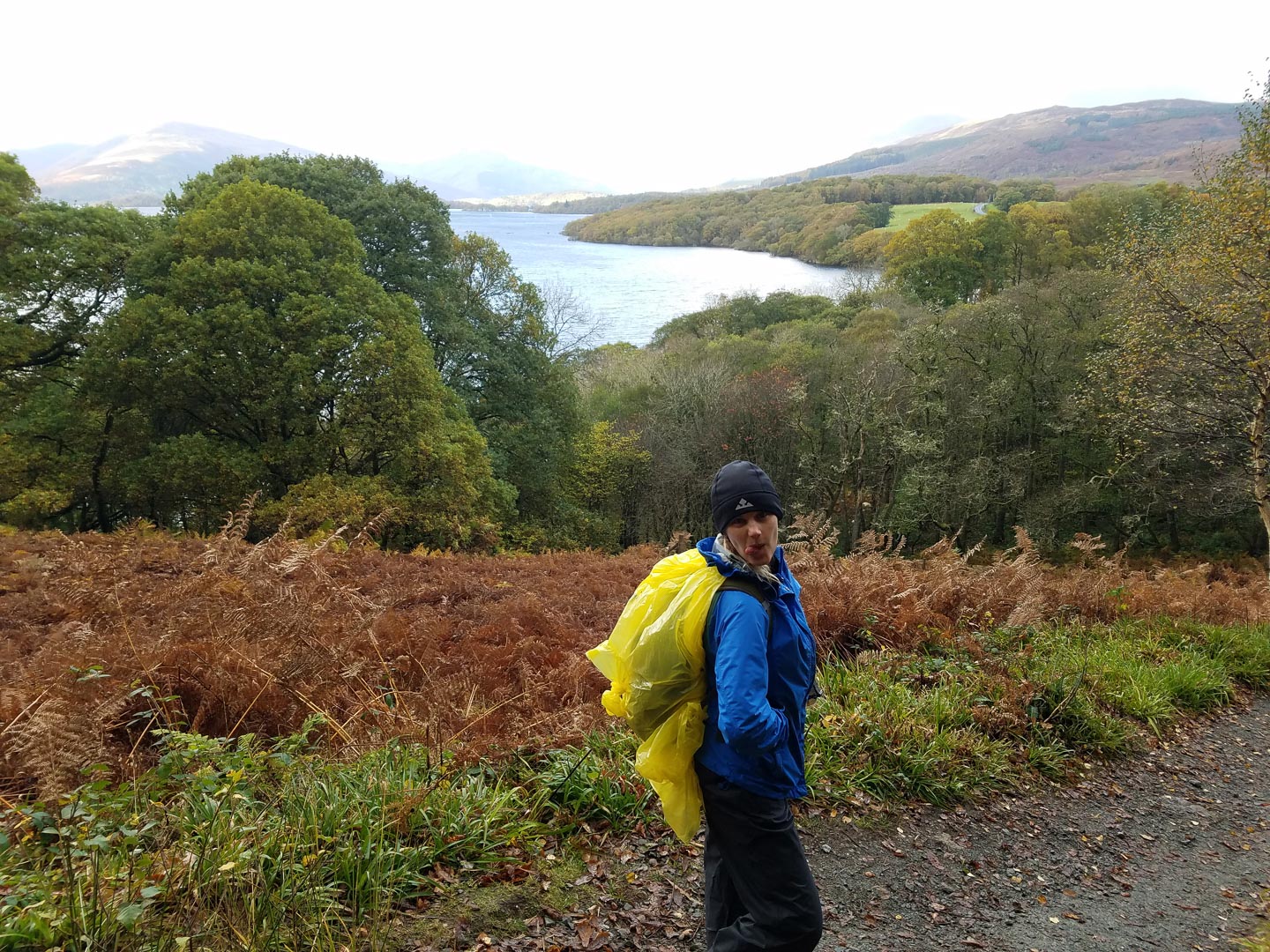
Loch Lomond
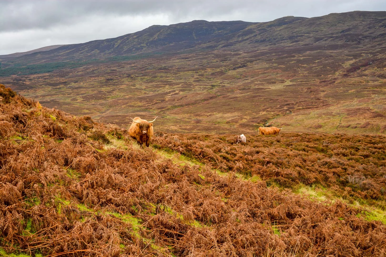
Scottish Highland Cattle
Day Three
Loch Lomond….still
Everyone told us the third day was the hardest of the trail, but I just could not totally believe them when we looked at the elevation profile it was just a lot of little ups and downs, but for the most part looked primarily flat. The trail took us along the edge of Loch Lomond for the second day in a row, it gives you a sense for the size of this lake when it takes us two 14-mile days to walk it! We found out why everyone said this was the hardest day as we snaked up and down the rocky stair steps along the lake edge. Honestly, this is the type of terrain I had expected the whole way and it was not that bad in comparison to other hikes we have done in Peru and Morocco. What did hurt towards the end of the day was our feet from the constant pounding the rocks were delivering each step of the way. I was excited for this day knowing that it was drawing us in closer to the heart of the highlands and giving us beautiful lake and mountain views (which we both love). The weather also cooperated with us for a good part of the day offering some transient rays of sunshine and occasional blue skies for an amazing photo opportunity if you were fast enough.
Towards the end of the day we were again ready to get to our campground for the night to rest our feet and we were pleading with the lake to finally end knowing our camp was a short way upstream of the lake. As exhausted as we were it was already decided that we would walk the ten minutes from our campsite to the Drovers Inn for dinner and a beer because it is one of the oldest pubs in all of Scotland and we had to keep our historic pub crawl going! The drovers in got its name from the cattle drovers that years ago would herd their cattle down the banks of Loch Lomond to market. This was obviously a stop frequented by them. The stone structure shows its age with pride and is decorated with dozens of stuffed animals, some of them exotic and slightly disturbing. The inn is also known as the most haunted building in all of Scotland with the ghost of a drover said to be seen wandering the halls late at night. Too bad we couldn’t afford a night here for a chance to see some history face to face. Anyways we had a couple beers and vegetarian bangers and mash which was delicious after so many miles on the trail. We definitely recommend making a stop here if you are making your way down the trail.
Pondering if we will ever reach the end of Loch Lomond
Day Four
As fate may have it our favorite walker bounded into the bar just as we had sat down to order our breakfast. We saw this man two days prior while eating breakfast in Drymen and were instantly entertained by his plastic map pouch that hung around his neck, dual walking sticks, red jacket, and the swagger of Steve Urkle. As we sat eating breakfast we saw him make a move across the street for the grocery store not seeing the handrail on the other side protecting the sidewalk. Either ashamed by his silly mistake or extremely overconfident in his hurdling skills he decided to roll himself, pack and all, over the railing instead of walking the 20 feet around the rail to get in the store. We were extremely pleased with all of his decisions that morning, hehe. We also saw him pop out of the grocery store a couple of times and back in before he darted back down the road towards the trail.
Our heads rose just in time to see the red jacket fly by on his sprint to the bar to drop off his key and check out. He was a whirlwind of chatter once the barkeep came out to collect the key spouting off about his pace the last couple days and how he must hasten it today and he thinks he can because it’s military road ahead. The barkeep jokingly provoked him saying at the worst you could catch a bus and in a furry of haste he turned and bolted for the door but not before yelling back to the barkeep “not my style at all my man!” We smiled and silently thanked the barkeep for the entertainment when he brought us out our full Scottish vegetarian breakfast. One thing they do right around here is fill you up for breakfast. Each morning we have had toast, sausage, mushrooms, tomato, beans, potato scones, and eggs.
With full bellies we set out on our 12 miles for the day, looking forward to our day of rest we had planned once we reach Tyndrum. The trail took us on a gradual ascent all morning through pasture lands of sheep and cows. We had one interesting encounter when checking our mileage and course while there were a couple cows around. I pulled out the map and while I checked the landmarks around us to compare to the map, Lauren silently watched the two cows we had passed a hundred feet back slowly creep up behind us. When they got within 20 feet and just stared at us we began to feel uncomfortable and started to move along. So did the cows. The followed slowly and at a distance until we came over the next hill and saw all their friends congregating right on the trail and around our gate to get through the fence. To make this more complicated this was one of the wettest and muddiest sections of the trail we had seen yet, and Lauren’s boots are only water resistant, not waterproof like mine. So we are tip toeing around the pockets of mud and puddles while keeping an eye on the dozen cattle surrounding us hoping that they all remain calm. We were careful not to get to close behind them, so we didn’t get a surprise kick. We slowly made our way to our exit and said farewell to the one cow standing patiently by the gate pleading with his eyes to be let out.
Lunchtime in a pine forest!
Trying to get some Vitamin D
Close to the halfway point for the day we entered into a pine tree forest that gratefully protected us from the wind for a couple of hours. It was a beautiful sight with about half of the pine trees a dark green color and the other half yellowish. After a bit of research we think this is the hybrid larch which changes color in the spring, autumn, and winter and has deciduous needles which we saw all over the ground. One constant that we have begun to notice along the trail is the constant trickle of springs and streams. On day three I began to pay attention and by day four I am convinced that about every 50 paces we see a spring or stream running down the hillside which is not surprising with how damp and rainy it is in the highlands. Even when it’s not raining it can be misting from the low cloud cover. We have become very fond of our waterproof pants and rain jackets. With all of that moisture in the air and the occasional ray of sunshine one would think rainbows would be all around the moment the sun popped out, but it took us four days until we saw our first one and it was well worth the wait! When we finally made it to our campsite for the night we were pleased to see our favorite walker had just checked into a room at the hostel. We stayed in a camping cabin here for two nights to give ourselves a day break from the trail which was a life saver with Lauren coming down with a cold. We also enjoyed our next four meals at The Real Food Café in Tyndrum and had a different vegan meal each time! The small town was just big enough to supply us with a small minimart to restock on lunches and entertain us for a day while we rested.
Day Five
A day of less than 10 miles sounded like such a treat to our achy feet and the rest day allowed us just enough time for Lauren to kick her cold and me to rest my knees. From looking at the weather report we feared that we may have wasted one of our best weather days on our rest day and the cloud cover today was ominous. We got our start after our fourth and final delicious meal at the Real Food Café leaving around 9:30. With the cloud cover so thick Lauren and I quickly drifted into deep and meaningful conversation like what would we do if it was us that won the 1.6 billion dollar jackpot like that lady in North Carolina and the day flew past. Maybe we were just well rested or perhaps the first four days on the trail had slowly toughened us up, but when we stopped just before noon to check where we were we had already cranked out six of the nine miles for the day. We decided to just push on through and eat our PB&J’s when we got to our hotel in Inveroran. We didn’t see much great scenery on this day thanks to the weather, but we made great time!
She ate all the flowers!!!
After some R&R at the hotel and just before heading down for dinner we could hear several voices coming from the bar in the hotel, so we decided to join after we ate. We got the last couple seats in the cozy bar and became fast friends with a couple of Canadians on holiday also hiking the WHW. We also met a young lad from the US and a group of four Dutchmen traveling together on an annual mancation. The lively conversations in the bar were only broken by the extremely dry sarcasm of the Romanian working the bar when somebody would ask for another drink. The party lasted past midnight, but we excused ourselves around 11 so we would not be sorry the next morning on the trail.
Day Six - Finally Clear Skies!!!!!
While looking at the elevation profile of the trail we both thought the second half of the trail looked more intimidating with much more vertical change than the first half, so we aimed to get an early start on the sixth day. We did get an early start, but quickly lost track of time when we walked outside to the most beautiful clear sky we had seen yet while in Scotland. We were happy that we stalled taking some pictures and adding more layers to fight the bitter cold on this day because it gave our new Canadian friends enough time to finish their packing and walk out of the hotel.
Their sign said they are were waiting here in protest until they become a post card for the West Highlands Way
We walked with them the eight miles we had scheduled for our day which was less than half of the 20 miles they had planned! However, before we got too far down the trail we joined in on an offer to have some coffee and tea at the home of one of the Scotsmen we all met in the bar last night. After some sipping and chit chat we hit the road in haste to make up the time since they were walking 20 miles today and not only 8 like Lauren and I. It seems like everyone else on the trail took the website at its word when it said there were no facilities at Kingshouse. I did some looking around nearby and found a ski resort that rented some hobbit houses which was our pad for the night.
Check out this grass ya’ll
When we made it to the Glencoe mountain resort we all rode the ski lift up to the top of the mountain where we parted ways with our Canadian friends. Lauren and I continued to hike up a little way to the top of the mountain to see what view we would get on this clear day and nearly got blown off the mountain top by the arctic gusts.
Riding the chair lift and braving the cold!
Mountains of Glencoe
Where’s my glove!????
The field goal is gooooood!!!
Mountains of Glencoe
Our Hobbit Hut!!!!!
Day Seven
Glencoe
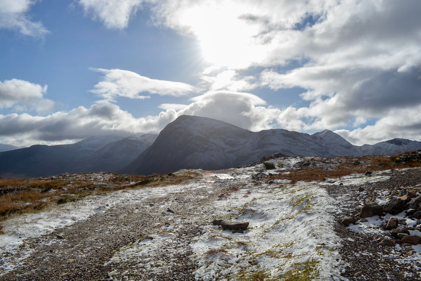
We woke the next morning to snow on the ground and another gorgeous, but frigid morning. The arctic air blowing in seemed to be clearing the skies for us which we much preferred over being wet and warmer. Today we go over the highest pass on the hike called the devil’s staircase which has me only slightly concerned. I am more focused on the steady long decent the second half of the day today because last night my left knee began hurting suddenly when going down even a slight decline. All bundled up we made our way down the valley and towards the devil’s staircase.
Glencoe
We were in awe of the beauty surrounding us and wondered what we might have missed on the couple of overcast days at the start of the hike. This section of the trail through Glencoe is said to be some of the most beautiful scenery along the way and we can certainly see why.
Glencoe
The ascent of the devil’s staircase was easier than the name suggests and once at the top we had a skyline of mountain peaks surrounding us in every direction. I believe we could see Ben Nevis (the tallest mountain in the UK) peaking over the tops of the other mountains far off in the distance marking our approximate end of the trail. The wind was whipping so hard and cold at the top of the pass we could only snap a few photos before we began to freeze.
At the top of the highest pass of the trail…the devil’s staircase (the name is way more intimidating than the climb)
We quickly realized on our descent that the show and ice on the trail had not yet thawed on this side of the mountain. It was a slow descent for me with my knee wincing with every downward step, I even resorted to walking downhill backwards when the trail opened up into a gravel road at the lower elevations. I was so relieved when we finally made it to the town of Kinlochleven where we were to stay for the night. We enjoyed a beautiful sunset with some beers and dinner while we rested up and anxiously awaited the 16 miles to come tomorrow.
Gorgeous sunset
Day Eight
Morning fog on the lake and moon still in the sky when we set out on our eight and final day on the trail…
Luckily, we got an extra hour of sleep for our longest day thanks to daylight savings time! The day started with a steep uphill climb out of town and led us into a seemingly never-ending valley. As we walked through the valley for hours, surrounded by snowcapped peaks, we passed by the ruins of some old houses. We could not believe that people survived out here hundreds of years ago with how remote it is and cold it can get!
When we would walk out of the sunshine and into the shadow of a mountain the temperature would easily drop 20 degrees instantly. It took us all morning to walk our way through the valley and little did we know that where we stopped for lunch, Ben Nevis was waiting for us on the other side of the next hill standing at 4,413 feet. We were very fortunate to have a clear day so we could see the white snow covered peaks of the mountain against the blue sky.
The white capped Ben Nevis tallest mountain in the UK
What a beauty! (lower left of course)
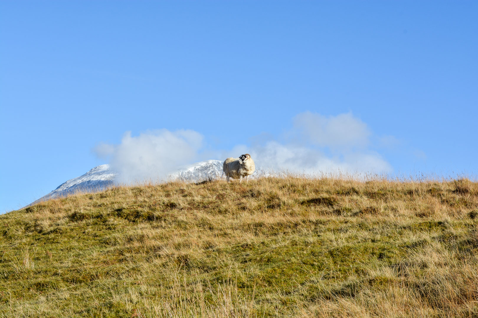
Baaaaa-raaaaam-youuuuuu
The second half of the day had a lot of descent down towards Fort William mostly following a gravel logging road. I believe it was around mile 14 that our feet began to yearn for the end of the trail. Walking the last couple miles into town was flat and easy going, but it certainly did drag on as we got into town hoping that around each corner we would see the statue of the man with sore feet, marking the end of the trail. When we finally turned the last corner and saw the statue we both let out a sign of relief for our tired legs and achy feet.
This hike was the longest by distance and number of days for both of us by a long shot. We highly recommend this hike to people of all physical aptitudes as the hiking is not technical nor difficult. All it takes is the determination to see it through and the courage to say yes and start planning it. We loved the time of year we did this hike too because we avoided the heavy crowds, allowing us to enjoy the natural beauty even more plus all of the midges were gone. For those who don’t know midges are really annoying insects somewhere between a mosquito and gnat that attack without mercy in the warmer months. Anyways we hope this might inspire you to get outdoors and take a walk in the woods for some fresh air and exercise. Happy trails!


